
Beiyixi Fm
Type Locality and Naming
Kuruktag region. The Beiyixi Fm was named by E. Norin (on reconnaissance survey of the west Kuruktag) in 1937. The typical section is situated at Beiyixi (Baiyixi) valley in Aletonggou in West Kuruktag, Xinjiang Weiwuerzhu Zizhiqu (Xinjiang Uygur Autonomous Region). Lowermost formation of the Kuruktag Gr (1 of 9).
Synonym: (贝义西组)
Lithology and Thickness
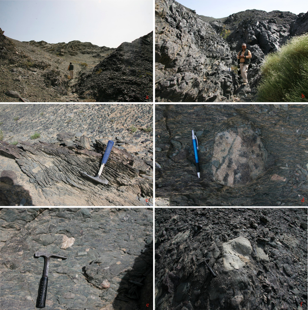
The Beiyixi Fm is dominantly composed of marine clastic rock, volcanic rock and diamictite (glacial rock), intercalated with minor carbonate rock, commonly bearing a layer of basal conglomerate at the bottom. Along the strike, volcanic rocks (including intermediate-basic volcanic lava, agglomerate and pyroclastic rock) are interbedded with clastic rock, varvite, and diamictite (glacial rock). With a variable lithology and thickness, the Beiyixi Formation in West Kuruktag has clastic rock, with varved slate and diamictite (glacial rock), and bears many intercalations of carbonate rock. Eastward to Yardang Mountain or southward to Yulegunbulak area, the Beiyixi Formation is dominated by volcanic rock and the thickness is increasing, which varies from 640 to 1670 m.
[Figure: The diamictite of the Beiyixi Formation in western hill, Kuerle, Xinjiang]
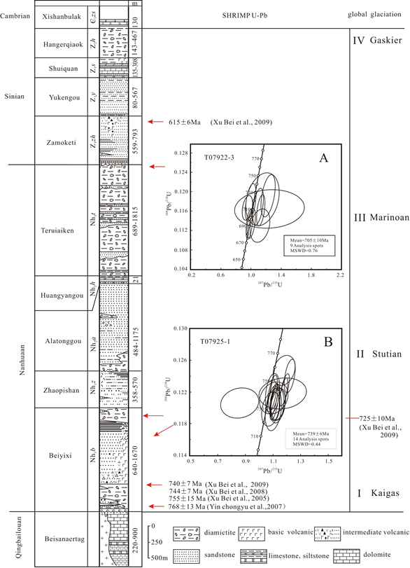
[Figure: Stratigraphic Column of the Kuruktag Gr]
Relationships and Distribution
Lower contact
The Beiyixi Fm unconformably overlies the Pargangtag Gr (Beisainartag Fm of Qingbaikouan System), where the basal conglomerate or glacial rock probably onlaps different horizons.
Upper contact
Its top is conformably overlain by the Zhaobishan Fm
Regional extent
Kuruktag region. The Beiyixi Fm is dominantly exposed in Kuruktag region, west from Baishibulak and Xishankou (west of Korla City), eastward to Zhaobishan and Xingertag (in north Yuli County) and Yardang Mountain on the south, then to Yulegunbulak (south of Shanshan County).
GeoJSON
Fossils
The Beiyixi Fm yields microplants Asperatopsophosphaera umishanensis, Pseudoznosphaera uerrucosa, Trematosphaeridium holtedahlii, Leiopophosphaera sp., etc.
Age
Depositional setting
Glacial
Additional Information
The age of the volcanic rock in the lower part is determined to be 814.1±97.3 Ma (Rb-Sr method, Wang Jiongzhang et al., 1988) and the granite intruded into the underlying Pre-Sinian metamorphic rock that is unconformably overlain by the Beiyixi Formation is determined to be 920.6±90.9 Ma (by Rb-Sr method). Therefore, the age of the lower boundary is inferred to be 800 to 850 Ma. Based on the data reported by Li Yong'an (1984), the paleolatitude is 32.6° and the paleomagnetic pole is -6. 6°ψ; 36. 9°λ.